

Raymarine
Raymarine LightHouse North America Chart - R70794
Item: #878919 | Part Number: R70794$159.99


Description
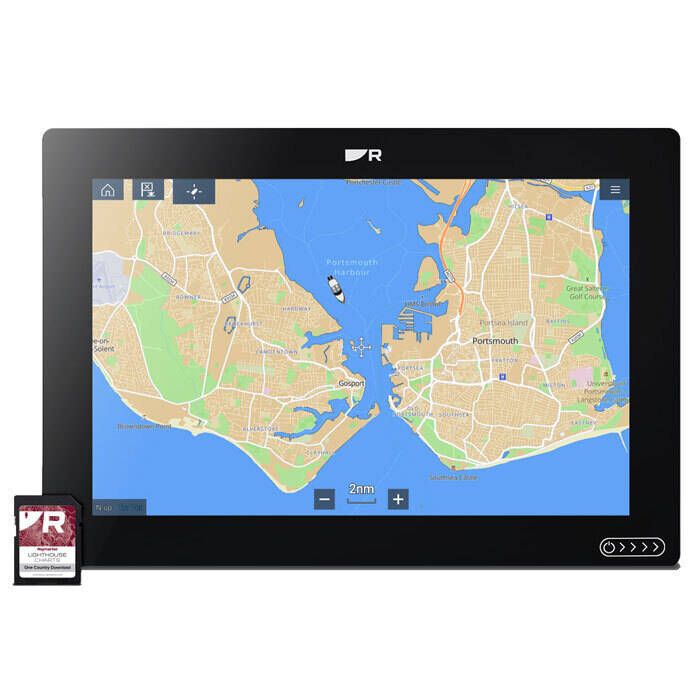
The Raymarine LightHouse North America Chart R70794 delivers exceptional clarity and detail for confident navigation across coastal and inland waters. Featuring comprehensive coverage, customizable chart symbols, and advanced fishing insights, it enhances situational awareness and helps you make the most of every outing.
Raymarine LightHouse North America Chart - R70794 Item # 878919
Description
Raymarine's LightHouse North America Chart offers maximum readability, intuitive navigation, and superior quality that brings a new level of clarity to marine navigation.
Features:
- Provides superior quality charts for the North East, East, Mid Atlantic, South East, Heartland, Hawaii Pacific, South West, West, North West, Alaska, Great Lakes and the Bahamas
- Incorporates detailed and in-depth maps of popular lakes, rivers and ponds for freshwater anglers
- Chart symbol controls give you the power to customize the charts to your personal preference. Change the size of channel markers, points of interest, and other icons for complete control over chart details
- Data-rich points of interests including marinas, boat ramps and access points, fuel docks etc
- Unrivaled fishing intel presents submerged structure and bottom composition, expert-verified local fishing tips and Fishing Hot Spots®
- RealBathy™ Personal Sonar Mapping - create your own bathymetic charts with live sonar mapping; further improving the accuracy of existing charts
- Four distinct color palettes provide the best possible viewing conditions around the clock: Day, Dusk, Dark and Bright Sun modes
- For use with Axiom, Axiom Pro, Axiom XL and Element multifunction displays
Specifications:
- Coverage Area: North America (North East, East, Mid Atlantic, South East, Heartland, Hawaii Pacific, South West, West, North West, Alaska, Great Lakes and the Bahamas)
- Applications: Axiom, Axiom Pro, Axiom XL, Element Multifunction Displays
- Card format: SD Card
Note: Multifunction display sold separately.
Part Numbers for Raymarine LightHouse North America Chart - R70794
Reviews
Rated 3 out of
5
by
Todd from
Charts are just OK, good extra info
The Lighthouse charts are just OK. They look nice enough but seem to lack the depth contours and details I have on my Navionics charts. Also Raymarine doesn't seem to update the data as often. The Lighthouse charts do have nice extra info and POIs from Waterway Guide a nice satellite photo overlays.
Date published: 2025-12-27
Questions
Does the chip need to be updated
Generally, yes. I believe you can update it right from the unit.
Date published: 2023-10-02