

Garmin
Garmin GPSMAP 1022 Non-Sonar Chartplotter with Worldwide Basemap - 010-01740-00
Item: #956184 | Part Number: 010-01740-00$1,399.99

Description
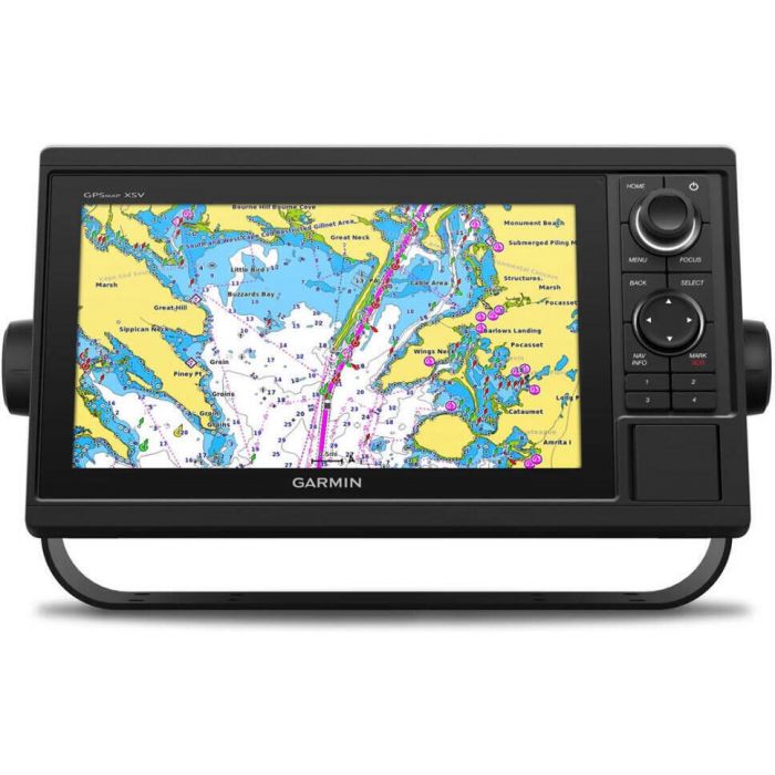
The Garmin GPSMAP 1022 Non-Sonar Chartplotter delivers a crisp, connected helm experience with a sleek 10" IPS display and powerful processing. Preloaded with a worldwide basemap, it offers advanced navigation, seamless system integration, and smart connectivity for confident cruising and fishing.
Garmin GPSMAP 1022 Non-Sonar Chartplotter with Worldwide Basemap - 010-01740-00 Item # 956184
Description
Get a sharper view from your connected helm. With its sleek design, powerful processing and upgraded IPS display, this advanced 10" chartplotter integrates seamlessly into your Garmin marine system.
Features:
- With its added processing power and new slimline design featuring edge-to-edge glass and a smaller unit footprint, it's easy to retrofit this plotter in a wider range of dash configurations
- Preloaded Worldwide Basemap charts
- Get support and integration for your Force trolling motor (sold separately) to gain complete control while you fish
- View laylines, race start line guidance, enhanced wind rose, heading and course-over-ground lines, true wind data fields and tide/current/time slider, wind angle, set and drift, wind speed, polars and more
- Use the polar table to see key data, including how fast you should go at a certain wind angle and speed so you know whether you need to adjust sail trim
- If you have multiple compatible Garmin devices on your boat, you can share information such as maps, user data, radar and IP camera video
- Connect to compatible autopilots, digital switching, weather, Fusion-Link™ audio system, media, VHF, AIS and more from one screen
- Built-in Wi-Fi® connectivity pairs with the free all-in-one mobile app for access to the OneChart™ feature, smart notifications, software updates, Helm, Garmin Quickdraw™ Community data and more
- Connect with some of your favorite devices, such as quatix® marine watches, gWind™ Wireless 2 transducers, GNX™ Wind marine instruments and wireless remote controls
- Pair your inReach satellite communicator to your chartplotter, and type custom messages by using your MFD's on-screen keyboard
Specifications:
- Dimensions: 12.5" x 7.3" x 2.7" (31.8 x 18.5 x 6.9 cm)
- Weight: 4.1 lbs (1.85 kg)
- Waterproof: IPX7
- Display type: WSVGA, NP
- Display size: 8.8" x 4.9"; 10.1" diagonal (22.4 x 12.5 cm; 25.7 cm diagonal)
- Display resolution: 1024 x 600 pixels
- Mounting options: Bail or flush
- Accepts data cards: 2 microSD cards
- Waypoints: 5,000
- Track points: 50,000
- Tracks: 50 saved tracks
- Navigation routes: 100
- Power input: 10 to 32V DC
- Typical current draw @ 12V DC: 1.9A
- Maximum current draw @ 12V DC: 2.7A
- Maximum power usage @ 10V DC: 32.4W
- Traditional sonar (dual frequency/beam): Yes (with external black box, sold separately)
- ClearVu: Yes (with external black box, sold separately)
- SideVu: Yes (with external black box, sold separately)
- NMEA 2000® ports: 1
- Connections NMEA 0183 input ports: 1
- NMEA 0183 output (TX) ports: 1
- Video input ports: 1 (BNC composite)
- Garmin marine network ports: 2
Included:
- GPSMAP 1022 chartplotter
- Power/data cable
- NMEA 2000 T-connector
- NMEA 2000 drop cable (2 m)
- Bail mount kit with knobs
- Flush mount kit with gasket
- Protective cover
- Trim piece snap covers
- Documentation