

Garmin
Garmin GPSMAP 8412xsv Sonar Chartplotter with Worldwide Basemap - 010-02092-02
Item: #956235 | Part Number: 010-02092-02$3,219.99

Description
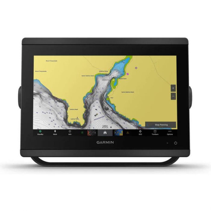
The Garmin GPSMAP 8412xsv is a powerful 12" sonar chartplotter that delivers MFD performance in a sleek, easy-to-install package. Featuring a full HD touchscreen with wide viewing angles and sunlight readability, it combines advanced sonar, networking, and navigation tools with a preloaded worldwide basemap for confident offshore and coastal cruising.
Garmin GPSMAP 8412xsv Sonar Chartplotter with Worldwide Basemap - 010-02092-02 Item # 956235
Description
This easy-to-use, easy-to-install GPSMAP 8412xsv chartplotter/sonar combo delivers MFD performance in a combo-size package. It features a 12" full HD in touchscreen display for wider viewing angles, superior clarity and sunlight readability, even with polarized sunglasses. Multiple displays can be flat mounted edge-to-edge to create a sleek glass helm look or can be mounted flush.
Features:
- Offers wider viewing angles, superior clarity and sunlight readability, even with polarized sunglasses
- Compatible with the GRID 20 remote (not included) which provides intuitive remote access and control of your entire Garmin marine system
- Pair your chartplotter with Panoptix or Panoptix LiveScope easy-to-interpret live sonar (transducer sold separately) to see all around your boat in real time
- View laylines, race start line guidance, enhanced wind rose, heading and course-over-ground lines, true wind data fields and tide/current/time slider, wind angle, set and drift, wind speed, polars and more
- Use the polar table to see key data, including how fast you should go at a certain wind angle and speed so you know whether you need to adjust sail trim
- If you have multiple compatible Garmin devices on your boat, you can share information such as maps, user data, radar and IP cameras among them
- Connect to autopilots, digital switching, weather, your FUSION-Link audio system, media, VHF, AIS and more from one screen
- Built-in Wi-Fi connectivity pairs with the free all-in-one mobile app for access to the OneChart feature, smart notifications, software updates, Helm, Garmin Quickdraw Community data and more
- Connect with some of your favorite devices, such as quatix marine watches, gWind Wireless 2 transducers, GNX Wind marine instruments and wireless remote controls
- Get quick, one-touch access to the information you need to ease high-stress situations such as docking. You can incorporate networked sonar, radar, cameras, media and more
- Pre-loaded with Garmin Worldwide Basemap
Specifications:
- Dimensions: 11.9" x 8.5" x 3" (30.3 x 21.6 x 7.6 cm)
- Weight: 6.2 lbs (2.8 kg)
- Waterproof: IPX7
- Display type: FHD, IPS
- Display size: 10.1" x 5.7"; 11.6" diagonal (25.7 x 14.5 cm; 29.5 cm diagonal)
- Display resolution: 1920 x 1080 pixels
- Mounting options: Bail, flat or flush (Garmin does not offer any hardware or accessories for a flat-mount installation. Professional tools and knowledge is required.)
- Accepts data cards: 2 microSD cards
- Waypoints: 5,000
- Track points: 50,000
- Tracks: 50 saved tracks
- Navigation routes: 100
- Power input: 10 to 32V DC
- Typical current draw @ 12V DC: 1.3A
- Maximum current draw @ 12V DC: 6.0A
- Maximum power usage @ 10V DC: 45W
- Traditional sonar (dual frequency/beam): Built-in (dual channel CHIRP, 70/83/200 kHz, L, M, H CHIRP)
- ClearVu: Built-in 260/455/800/1000/1200 kHz
- SideVu: Built-in 260/455/800/1000/1200 kHz
- NMEA 2000® ports: 1
- Connections NMEA 0183 input ports: 1
- NMEA 0183 output (TX) ports: 1
- Video input ports: 1 (BNC composite); 1 HDMI (HDCP compliant)
- Video output ports: 1 HDMI
- J1939 ports: 1
- Garmin marine network ports: 2
Included:
- GPSMAP 8412xsv
- Power cable
- NMEA 2000® drop cable
- NMEA 2000 T-connector
- Bail mount with knobs
- Flush mount kit
- Sun cover
- Trim piece snap covers
- Documentation