

Garmin
Garmin GPSMAP 1222xsv Keyed Networking Chartplotter Combo with Worldwide Basemap - 010-01741-02
Item: #991026 | Part Number: 010-01741-02$2,299.99

Description
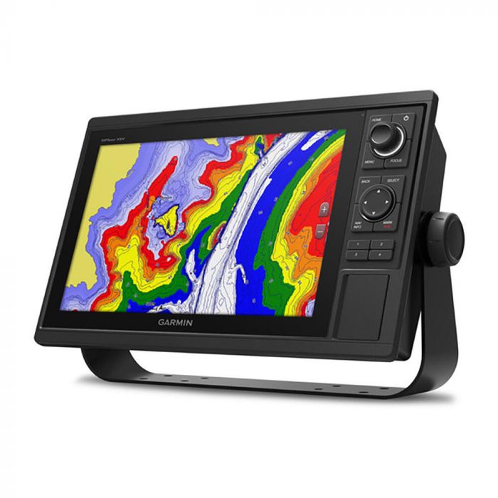
The Garmin GPSMAP 1222xsv Keyed Networking Chartplotter Combo delivers powerful navigation and sonar performance in a sleek, easy-to-use package. Featuring a bright 12" display, built-in CHIRP sonar, and worldwide basemap, it's designed for confident cruising, fishing, and sailing. Fast 10 Hz GPS, wireless connectivity, and full marine networking make it a versatile centerpiece for any serious helm.
Garmin GPSMAP 1222xsv Keyed Networking Chartplotter Combo with Worldwide Basemap - 010-01741-02 Item # 991026
Description
Garmin's GPSMAP 1222xsv Keyed Networking Combo is a premium chartplotter for the adventurous spirit. It features a large, bright screen coupled with a quick and easy-to-use keypad interface with user-programmable keys and a multifunction control knob to help you navigate with ease.
Features:
- Built-in single-channel CHIRP sonar
- ANT wireless connectivity directly to your compatible Garmin devices such as quatix® marine watches, gWind™ Wireless 2 transducers, GNX™ Wind marine instruments and wireless remote controls
- Built in Wi-Fi® technology gives you access to the free all-in-one ActiveCaptain app, so you can manage your marine experience from nearly anywhere on your compatible smartphone
- Use the polar table to view important data fields to help you trim your sails for maximum speed and efficiency
- Fast, responsive built-in 10 Hz GPS and GLONASS receiver refreshes your position and heading 10 times each second to make your movement on the screen more fluid
- Preloaded with worldwide basemap
- Fully network capable for the Garmin Marine Network and NMEA 2000® networking plus NMEA 0183 technology support
- Easily transfer waypoints, tracks or frequently used routes from other devices via industry standard GPX software formatting
- Allows sharing of sonar, maps, user data, dome or open-array radar, and Panoptix and LiveScope sonars among multiple units
- Read RPMs, fuel flow, temperature, trim and other important information at a glance
- Pair your inReach satellite communicator to your chartplotter, and type custom messages using your MFD's on-screen keyboard
Specifications:
- Dimensions: 14.1" x 8.9" x 2.7" (35.8 x 22.6 x 6.9 cm)
- Weight: 5.2 lbs (2.34 kg)
- Waterproof: IPX7
- Display type: WXGA, NP
- Display size: 10.3" x 6.4"; 12.1" diagonal (26.2 x 16.3 cm; 30.7 cm)
- Display resolution: 1280 x 800 pixels
- Mounting options: Bail or flush
- Input: Keyed
- Accepts data cards: 2 SD™ cards
- Waypoints: 5,000
- Track points: 50,000
- Tracks: 50 saved tracks
- Navigation routes: 100
- Receiver: 10 Hz
- Power input: 10 to 32V DC
- Typical current draw @ 12V DC: 2.2A
- Maximum current draw @ 12V DC: 2.9A
- Maximum power usage @ 10V DC: 34.8W
- Power output: 1 kW
- Tradtional sonar (dual frequency/beam): Built-in (single channel CHIRP, 70/83/200 kHz, L, M, H CHIRP)
- ClearVu: Yes with CHIRP (built-in)
- SideVu: Yes with CHIRP (built-in)
- NMEA 2000® ports: 1
- Connections NMEA0 183 input ports: 1
- NMEA 0183 input (TX) ports: 1
- Video input ports: 1 BNC
- Garmin marine network ports: 2
- 12-pin transducer ports: 1
Included:
- GPSMAP 1222xsv chartplotter
- Power/data cable
- NMEA 2000 T-connector
- NMEA 2000 drop cable (2 m)
- 8-pin transducer to 12-pin sounder adapter cable
- Bail mount kit with knobs
- Flush mount kit with gasket
- Protective cover
- Trim piece snap covers
- Documentation