

Garmin
Garmin GPSMAP 1222 Keyed Networking Chartplotter with Worldwide Basemap - 010-01741-00
Item: #991006 | Part Number: 010-01741-00$2,099.99

Description
- Fast 10 Hz GPS/GLONASS for smooth, responsive positioning
- Built-in worldwide basemap with advanced charting support
- Fully compatible with Garmin Marine Network, NMEA 2000, and NMEA 0183
- Integrated boat control, radar, sonar, and satellite communicator pairing
Garmin GPSMAP 1222 Keyed Networking Chartplotter with Worldwide Basemap - 010-01741-00 Item # 991006
Description
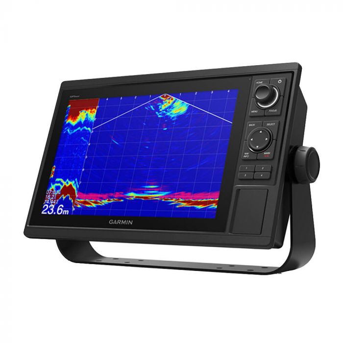
Garmin's GPSMAP 1222 Keyed Networking Chartplotter is a premium chartplotter for the adventurous spirit. This chartplotter features large, bright screens coupled with quick and easy-to-use keypad interfaces with user-programmable keys and multifunction control knobs to help you navigate with ease.
Features:
- Polar table to view important data fields to help you trim your sails for maximum speed and efficiency
- Fast, responsive built-in 10 Hz GPS and GLONASS receiver refreshes your position and heading 10 times each second to make your movement on the screen more fluid
- Built-in worldwide basemap included
- Fully network capable for the Garmin Marine Network and NMEA 2000® networking plus NMEA 0183 technology support
- Easily transfer waypoints, tracks or frequently used routes from other devices via industry standard GPX software formatting
- Garmin Marine Network support allows sharing of sonar, maps, user data, dome or open-array radar, and Panoptix and LiveScope sonars among multiple units
- Read RPMs, fuel flow, temperature, trim and other important information at a glance
- Pair your inReach satellite communicator to your chartplotter, and type custom messages using your MFD's on-screen keyboard
- Network with a Force® trolling motor and your compatible Power-Pole shallow water anchoring system to access advanced boat control features from your plotter including; smart anchor auto-deployment, smart anchor jog, auto stow, anchor drag detection and auto guidance end-of-route anchoring
Specifications:
- Dimensions: 14.1" x 8.9" x 2.7" (35.8 x 22.6 x 6.9 cm)
- Weight: 5.2 lbs (2.34 kg)
- Waterproof: IPX7
- Display type: WXGA, NP
- Display size: 10.3" x 6.4"; 12.1" diagonal
- Display resolution: 1280 x 800 pixels
- Mounting options: Bail or flush
- Input: Keyed
- Accepts data cards: 2 SD™ cards
- Waypoints: 5000
- Track points: 50,000
- Tracks: 50 saved tracks
- Navigation routes: 100
- Receiver: 10 Hz
- Activecaptain® compatible: Yes
- Power input: 10 to 32V DC
- Typical current draw @ 12V DC: 2.2A
- Maximum current draw @ 12V DC: 2.9A
- Maximum power usage @ 10V DC: 34.8W
- NMEA 2000® ports: 1
- Connections NMEA 0183 input ports: 1
Included:
- GPSMAP 1222 chartplotter
- Power/data cable
- NMEA 2000 T-connector
- NMEA 2000 drop cable (2 m)
- Bail mount kit with knobs
- Flush mount kit with gasket
- Protective cover
- Trim piece snap covers
- Documentation