

Garmin
Garmin GPSMAP 1022xsv Keyed Networking Chartplotter Combo with Worldwide Basemap - 010-01740-02
Item: #991025 | Part Number: 010-01740-02$1,599.99

Description
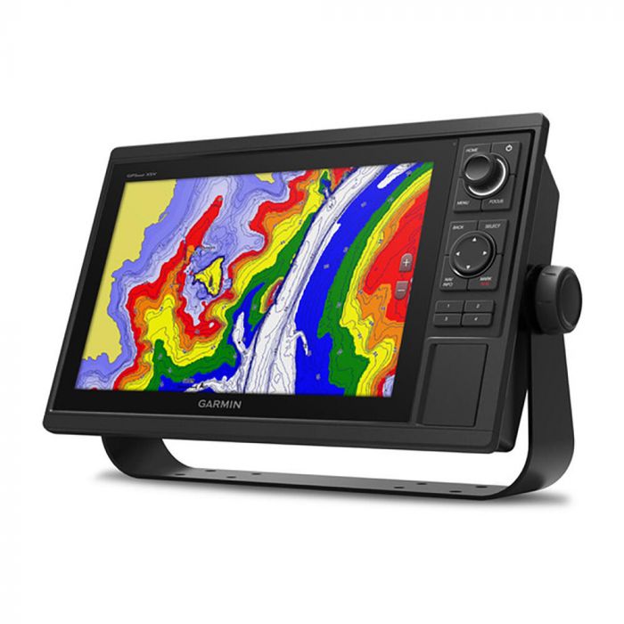
The Garmin GPSMAP 1022xsv Keyed Networking Chartplotter Combo delivers powerful navigation and sonar performance in a user-friendly, keypad-controlled design. Featuring a bright 10" display, built-in CHIRP sonar, and worldwide basemap, it offers fast 10 Hz GPS, wireless connectivity, and full marine networking for confident navigation and onboard integration.
Garmin GPSMAP 1022xsv Keyed Networking Chartplotter Combo with Worldwide Basemap - 010-01740-02 Item # 991025
Description
Garmin's GPSMAP 1022xsv Keyed Networking Combo is a premium chartplotter for the adventurous spirit. It features a large, bright screen coupled with a quick and easy-to-use keypad interface with user-programmable keys and a multifunction control knob to help you navigate with ease.
Features:
- Built-in single-channel CHIRP sonar
- ANT wireless connectivity directly to your compatible Garmin devices such as quatix® marine watches, gWind™ Wireless 2 transducers, GNX™ Wind marine instruments and wireless remote controls
- Built in Wi-Fi® technology gives you access to the free all-in-one ActiveCaptain app, so you can manage your marine experience from nearly anywhere on your compatible smartphone
- Use the polar table to view important data fields to help you trim your sails for maximum speed and efficiency
- Fast, responsive built-in 10 Hz GPS and GLONASS receiver refreshes your position and heading 10 times each second to make your movement on the screen more fluid
- Preloaded with worldwide basemap
- Fully network capable for the Garmin Marine Network and NMEA 2000® networking plus NMEA 0183 technology support
- Easily transfer waypoints, tracks or frequently used routes from other devices via industry standard GPX software formatting
- Allows sharing of sonar, maps, user data, dome or open-array radar, and Panoptix and LiveScope sonars among multiple units
- Read RPMs, fuel flow, temperature, trim and other important information at a glance
- Pair your inReach satellite communicator to your chartplotter, and type custom messages using your MFD's on-screen keyboard
Specifications:
- Dimensions: 12.5" x 7.3" x 2.7" (318 x 185 x 69 mm)
- Weight: 4.1 lbs (1.85 kg)
- Waterproof: IPX7
- Display type: WSVGA, NP
- Display size: 8.8" x 4.9"; 10.1" diagonal (22.4 x 12.5 cm; 25.7 cm)
- Display resolution: 1024 x 600 pixels
- Mounting options: Bail or flush
- Input: Keyed
- Accepts data cards: 2 SD™ cards
- Waypoints: 5,000
- Track points: 50,000
- Tracks: 50 saved tracks
- Navigation routes: 100
- Receiver: 10 Hz
- Power input: 10 to 32V DC
- Typical current draw @ 12V DC: 1.9A
- Maximum current draw @ 12V DC: 2.7A
- Maximum power usage @ 10V DC: 32.4W
- Power output: 1 kW
- Tradtional sonar (dual frequency/beam): Built-in (single channel CHIRP, 70/83/200 kHz, L, M, H CHIRP)
- ClearVu: Yes with CHIRP (built-in)
- SideVu: Yes with CHIRP (built-in)
- NMEA 2000® ports: 1
- Connections NMEA 0183 input ports: 1
- NMEA 0183 input (TX) ports: 1
- Video input ports: 1 BNC
- Garmin marine network ports: 2
Included:
- GPSMAP 1022xsv chartplotter
- Power/data cable
- NMEA 2000 T-connector
- NMEA 2000 drop cable (2 m)
- 8-pin transducer to 12-pin sounder adapter cable
- Bail mount kit with knobs
- Flush mount kit with gasket
- Protective cover
- Trim piece snap covers
- Documentation